Paw check
Live weather becomes a clear paw-burn safety call, calibrated against published veterinary data, plus the next safer walk window.
PetSignal checks paw-burn risk before every walk, maps 1,637 real council off-leash areas, and surfaces nearby hazards and lost-pet sightings — built by dog owners, for Australian dog owners.
Free on iOS. No account required to stay safe.
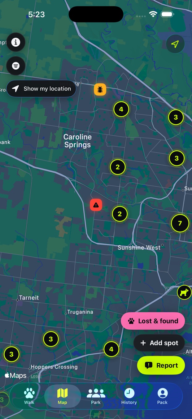
No attention traps, no ads. PetSignal earns the next open by being genuinely useful when your dog needs you.
Live weather becomes a clear paw-burn safety call, calibrated against published veterinary data, plus the next safer walk window.
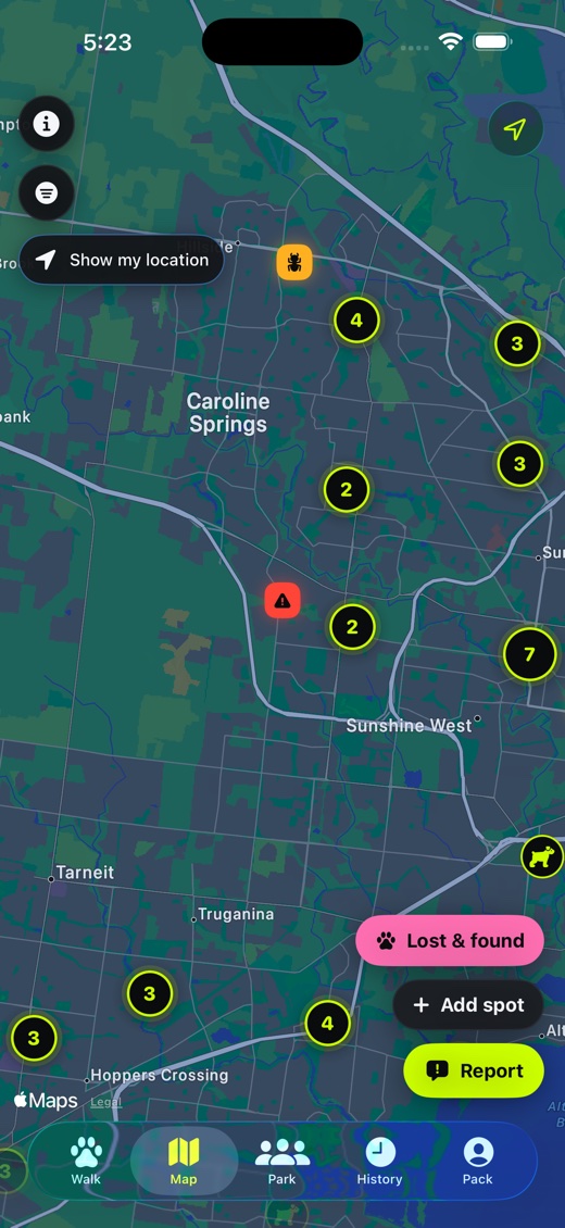
1,637 council-sourced off-leash areas across 36 councils, with fencing status and usage rules wherever the council publishes them — not empty map pins.
Sightings, photos, direction and time link straight back to the original alert, so nearby owners can act together fast.
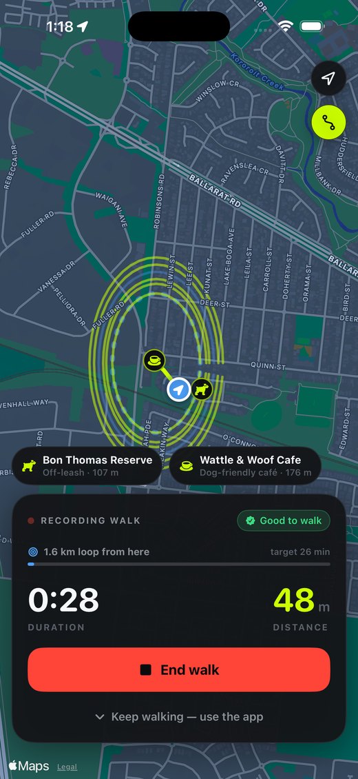
A heading-aware map arrow and spoken directions — "turn left in 50 metres" — read your route out loud, even with the phone locked.
Ask about barking, reactivity or recall. PetSignal uses Apple’s private on-device model where available, with a clearly labelled hosted assistant and an unlimited bundled guide as fallbacks.
Snakes, ticks, glass, toxic plants and mess hotspots reported by nearby owners, so you know what's ahead before your dog does.
Real screenshots, not mockups — scroll to follow one walk from the front door to the loop back home.
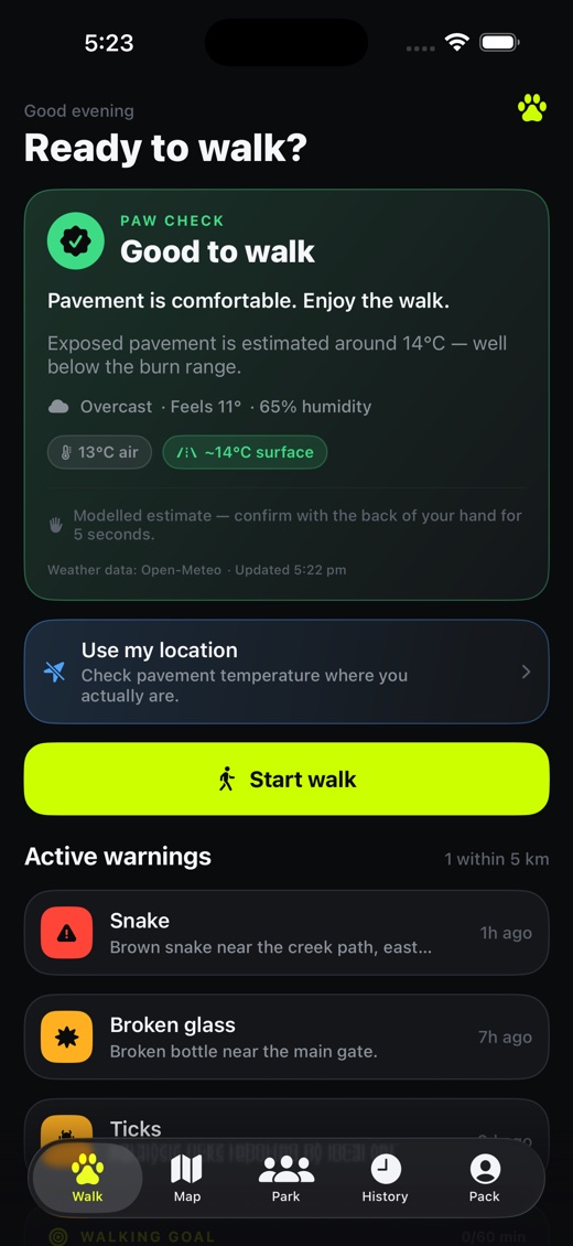
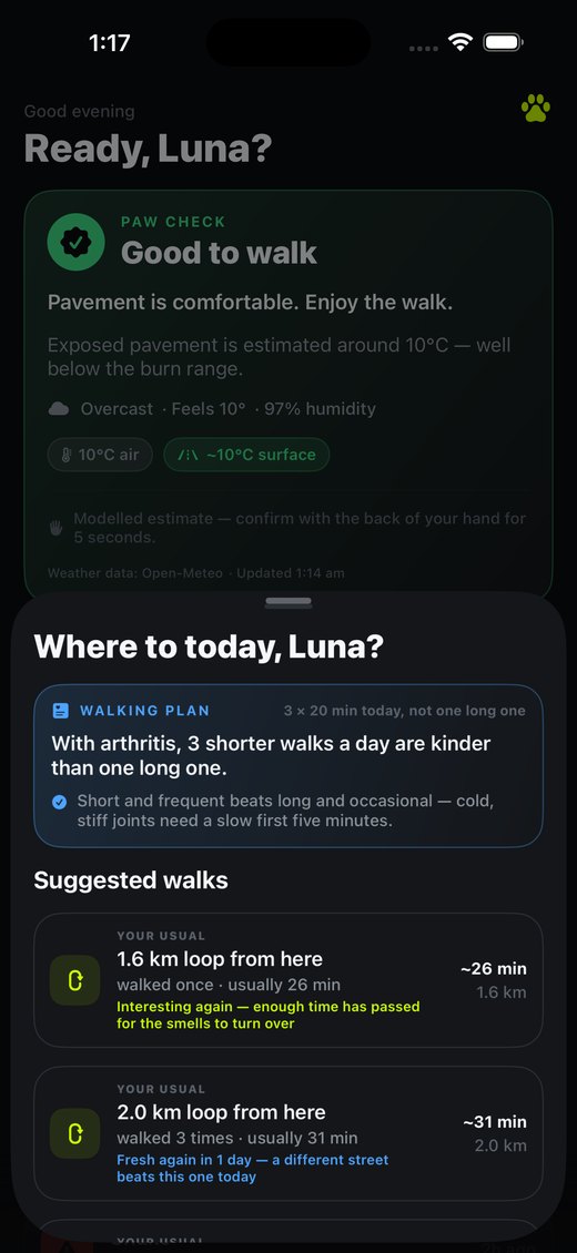
Open the app and get an instant paw-burn call for right now, plus anything nearby worth knowing about — a snake sighting, broken glass, a tick warning from a local vet.
1,637 real council-sourced off-leash areas across Melbourne and beyond, clustered so a whole city stays readable — plus live hazard pins and Lost & Found reports from nearby owners.
Your route draws live on the map, with nearby off-leash areas and dog-friendly cafés surfaced as you pass them — and spoken turn-by-turn directions if you're following a planned loop.
PetSignal remembers the loops you already walk and tells you which ones are due for a rotation, so the same walk doesn't get stale for a dog that notices everything.
Paw checks, off-leash maps, hazard warnings and lost & found will never sit behind a paywall. That's the whole point of the app.
PetSignal provides guidance, not veterinary advice. Always use your own judgement and follow on-site council signage. In an emergency, contact a vet or the Animal Poisons Helpline.
Yes. Paw checks, maps, hazards, lost & found, spoken navigation and all of your walk history stay free. Free also includes three hosted-AI answers a day and three weekly plans a month. Pack adds more AI, unlimited planning, multi-dog profiles, unlimited smart places and GPX export.
It's a model calibrated against published veterinary data — at 25°C air temperature, full-sun asphalt can reach roughly 52°C, hot enough to burn a paw in about a minute. Treat it as strong guidance, and always confirm with the back-of-hand test before you walk.
No. Location checks conditions and nearby places while you use the app. If you actively record a walk, tracking continues while the screen is locked so the route is not broken; iOS shows its location indicator and tracking stops when the walk ends. There are no advertising SDKs, and we never sell your data.
iOS first — no date yet for Android. We're building for iPhone owners now and will share news when there's something real to say.
Email us and we'll send you a TestFlight invite. You'll need Apple's free TestFlight app installed; the invite link then installs PetSignal.
Ask for a TestFlight invite and help shape PetSignal before the public launch.